SRF partnered with the St. Louis County Planning Department and GIS (Geographic Information Systems) staff to overhaul the County’s existing comprehensive plan. Located in northeastern Minnesota, St. Louis County is the largest county by area in the state and includes cities such as Duluth, Virginia, and Hibbing. The project involved a close collaboration between SRF’s land use planners and county staff to shape a future vision grounded in community input and spatial analysis.
SRF managed the full planning process, leading public engagement efforts, coordinating with GIS teams, and writing the final plan document. With weekly check-ins and clear roles, SRF and County staff ensured alignment throughout each phase.
GIS-Driven Planning Tools
- Land Use Suitability Analysis: Using numerous GIS datasets, SRF created composite maps identifying land most suitable for development, accounting for both constraints (e.g., wetlands, steep slopes) and advantages (e.g., proximity to roads and utilities).
- Alternative Land Use Maps: GIS tools were also used to merge public input with physical data, highlighting areas that align with both community preferences and development feasibility.
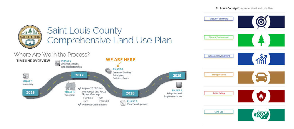
Public Engagement Strategy
To ensure broad community involvement, SRF coordinated:
- Online surveys (including high school student input)
- Wikimap tools for interactive feedback
- Two rounds of in-person meetings in four locations
- Regular updates via County email blasts
Resource Links:
Minnesota GIS Data & Maps
Internal Category:
Community Planning & Urban Design
Community Engagement
More from:
Minneapolis, MN