The Fargo-Moorhead (FM) Greenway is an opportunity to establish a signature destination for year-round outdoor recreation and serve as a catalyst for economic development. This 30-mile greenway will parallel the planned diversion of the Red River. Over the past 20 years, the FM area has experienced increased flooding events. Without protection, these flood events will have catastrophic consequences for area residents and businesses.
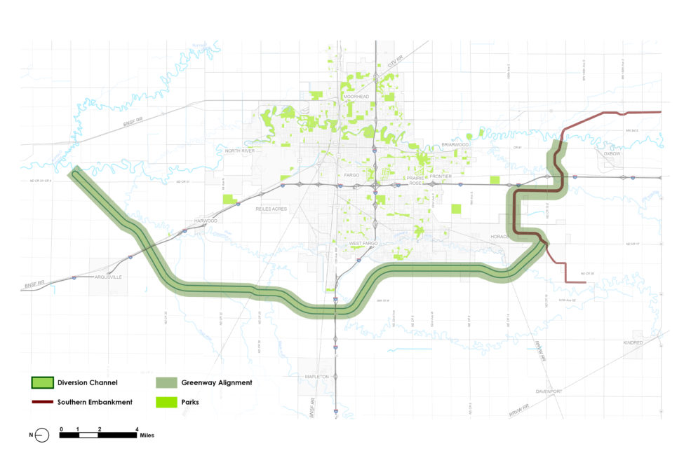
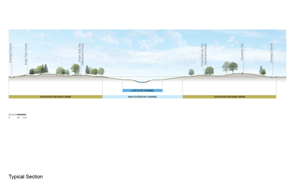
To guide the planning and implementation of enhanced flood protection for the community, the FM Diversion Authority was established. They coordinate with and receive assistance from the United States Army Corps of Engineers. A significant component of the planned flood protection is the creation of a channel that will divert the Red River flood flows around the west side of the community. An earthen embankment south of the community will supplement the channel to temporarily hold water during large food events, then release this water into the diversion channel. While the primary purpose of the diversion is protection from infrequent flood events, this public infrastructure corridor can concurrently function as a greenway to provide recreation opportunities to FM residents. Today, there is a gap in recreational opportunities in eastern North Dakota. Fargo-Moorhead residents travel over 50 miles to reach regional parks. The greenway will create a unique regional destination.
SRF led the greenway master plan effort. SRF led the greenway master plan effort, developed and implemented the planning process, facilitated stakeholder committee meetings, and led visioning and concept ideation. In addition, the SRF team led interactive public engagement events, prepared detailed analyses, and created compelling illustrations to help community members visualize how the flood control project could also serve a recreational purpose, and to generate community support and enthusiasm for the greenway.
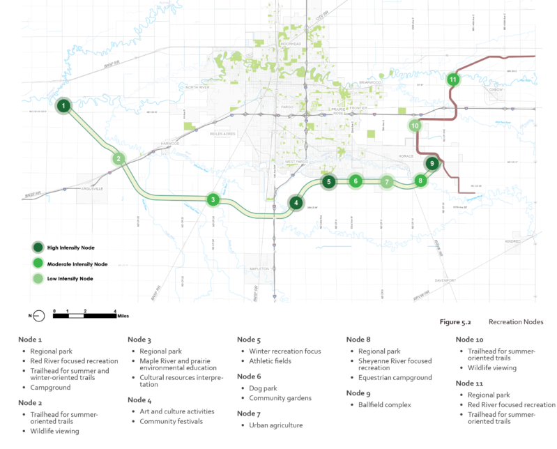
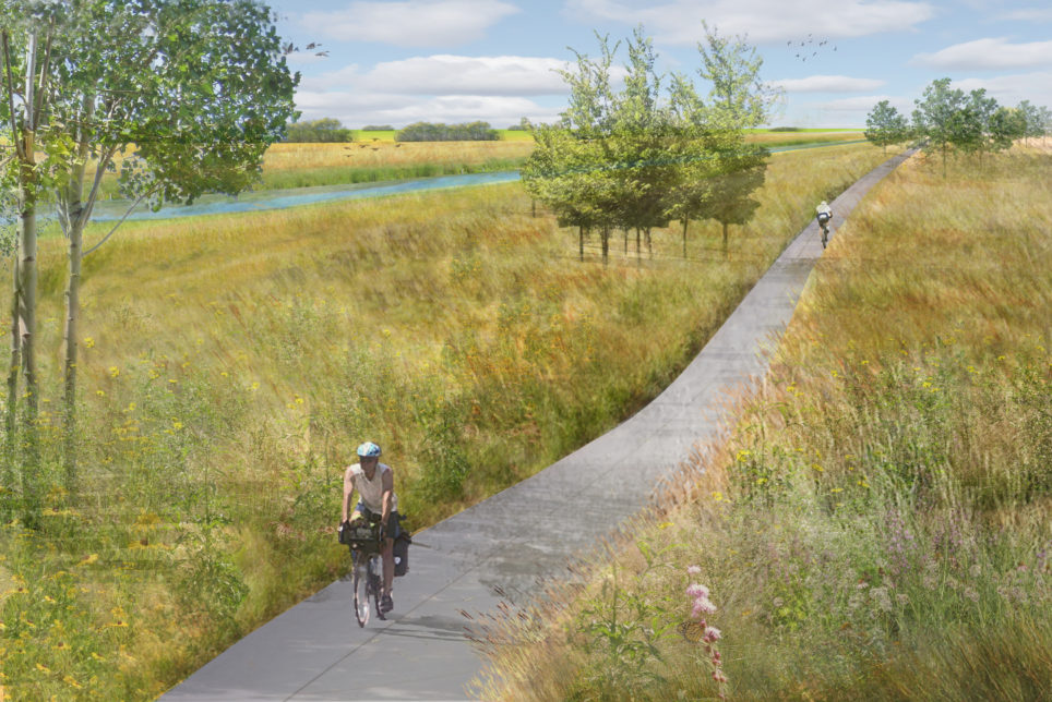
Proposed recreation features will vary in response to adjacent land uses, with a higher concentration of recreation activity nodes sited near existing and planned residential uses or existing natural resources. Greenway segments adjacent to agricultural uses focus on habitat creation and trails. Area residents expressed a clear desire for more trail experiences. Long-term, the greenway vision will provide year-round access for walking, jogging, biking, riding horses, and driving all-terrain vehicles. The snow season will provide opportunities to also snowshoe, cross-country ski, and snowmobile. Nodes along the greenway will create a wide variety of recreation and cultural activities. The masterplan includes nature-based recreational activities such as camping, fishing, and picnic areas; athletic fields for baseball, softball, or soccer; local food production opportunities introduce community gardens and urban agriculture. Area residents indicated a strong interest in social and cultural experiences that will be cultivated through seasonal festivals, performing arts, and public art.
The greenway trails and recreation nodes will be tied together with prairie plant communities, resulting in approximately 4,500 acres of new habitat for birds, pollinators, and other wildlife on land previously used for agricultural purposes. It also calls for the installation of approximately 9,000 new trees at strategic locations along the greenway.
Community Planning and Urban Design
Parks, Trails, and Recreation View All Projects