In recent years, one technological innovation has emerged as a game-changer in the field of civil engineering – drones. These unmanned aerial vehicles have soared to new heights, literally and figuratively, reshaping the way engineers plan, design, and execute projects.
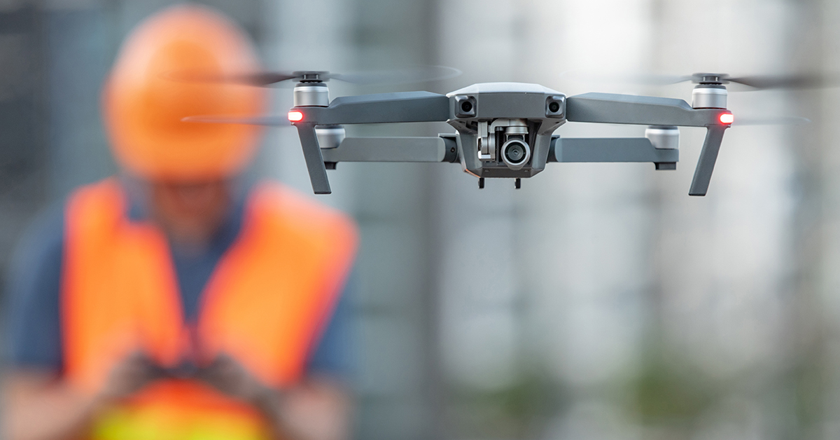
Drones, also known as unmanned aerial vehicles (UAVs), are remotely-operated aircrafts equipped with various sensors, cameras, and advanced software, enabling them to capture high-resolution imagery, collect data, and execute tasks with remarkable precision and speed.
Drones are revolutionizing civil engineering in various ways, creating a new era of efficiency and enhanced data analysis.
Advantages of Drone Technology in Civil Engineering
By providing a bird’s-eye view of construction sites, drones have redefined the way civil engineers plan, administer, and monitor construction projects. Here are some of the key advantages of drones in civil engineering:
Enhanced Surveying and Mapping Capabilities: Drones provide a swift and accurate solution for surveying and mapping tasks. Equipped with advanced sensors and GPS technology, drones can efficiently capture topographical data, creating detailed maps of terrain and structures.
High-Resolution Aerial Imaging: Drones are equipped with high-resolution cameras capable of capturing detailed aerial images. This capability is particularly valuable for civil engineers, as it allows them to obtain a comprehensive view of project sites, helping in planning and design phases.
Efficient Site Inspections and Monitoring: Traditional site inspections can be time-consuming and may involve safety risks. Drones can conduct regular site inspections, capturing real-time images and videos, which can be remotely accessed by engineers and project managers.
Accelerated Data Collection for Decision-Making: Drones accelerate the data collection process, providing engineers with up-to-date information that aids in making informed decisions promptly, addressing unexpected challenges, and optimizing project outcomes.
Detection of Structural Issues and Defects: Drones equipped with thermal imaging and other specialized sensors can identify structural issues and defects that may not be visible to the naked eye. This early detection allows engineers to address problems before they escalate, ultimately improving the quality and safety of the construction project.
3D Mapping for Accurate Terrain Modeling: Drones can generate 3D models of terrain and structures, providing engineers with precise data for design and analysis. These 3D models offer insights into elevation changes, slope analysis, and volumetric calculations, aiding in accurate project planning and earthwork estimating.
Cost and Time Savings: Faster data collection, reduced labor requirements, and more efficient decision-making processes translate into reduced project costs and quicker completion times. Additionally, drones help avoid costly rework by identifying issues early in the construction process.
Environmental Consideration: Drones minimize ecological disturbances during construction, research, and monitoring. Unlike traditional methods that may involve heavy machinery, drones are lightweight and can access remote or delicate areas without causing damage to the surrounding environment.
Legal and Regulatory Considerations
The integration of drones comes with its own set of legal and regulatory considerations that must be adhered to. Here are the key legal and regulatory considerations related to drone operations that professionals in the field should stay informed about:
Drone Operation Regulations in Civil Engineering: Governing bodies have established regulations to ensure the safe and responsible operation of these unmanned aerial vehicles. Regulations typically cover aspects such as flight altitude restrictions, no-fly zones near airports, and the need for drone registration. Compliance with these regulations is essential to avoid legal issues and maintain safety standards on construction sites.
Privacy Concerns and Compliance: Drones equipped with high-resolution cameras and sensors can capture detailed images and data, potentially infringing on the privacy of individuals or property owners in the vicinity of a construction site. Complying with privacy laws and regulations, such as obtaining consent or notifying individuals when drones will be used in their vicinity, is essential to avoid legal issues and respect privacy rights.
Licensing and Certification Requirements for Drone Pilots: Ensuring that drone pilots are properly licensed and certified is not only a legal obligation but also a crucial step in maintaining safety and professionalism on construction sites. These licenses typically involve passing a written exam, demonstrating flight proficiency, and adhering to ongoing training and recertification requirements.
Future Trends in Drone Technology for Civil Engineering
The future of drone technology promises even more exciting developments that will play a pivotal role in reshaping civil engineering practices. Two significant trends are set to shape the future of civil engineering:
Integration of Artificial Intelligence (AI): AI brings the power of data analysis and decision-making to a new level. Drones equipped with AI can process vast amounts of data rapidly and accurately. This means they can detect patterns, anomalies, and potential issues in real-time. For example, they can identify structural weaknesses or construction defects that might go unnoticed by human inspectors.
Swarm Technology in Construction: Swarm technology leverages the concept of “swarm intelligence,” where collective actions lead to intelligent and efficient behavior. In the construction context, this means that a swarm of drones can work together in a highly organized manner. They can perform tasks such as surveying, mapping, and material transport much faster than individual drones.
Get Started with SRF Consulting
From enhanced surveying and mapping capabilities to real-time project progress tracking, drones have proven to be transformative tools that boost efficiency, reduce costs, and improve safety in civil engineering projects.
As a leading consulting firm committed to improving the future of public and private infrastructure systems, SRF Consulting stands ready to collaborate with you. Contact us today to learn about the possibilities of technology in your civil engineering projects.
Frequently Asked Questions (FAQs)
Q: How do drones contribute to project efficiency?
A: Drones significantly enhance project efficiency by providing rapid and accurate data collection. They can conduct surveys, monitor progress, and inspect structures much faster than traditional methods, reducing project timelines.
Q: Are there specific regulations for drone usage in construction?
A: Yes, there are specific regulations governing drone usage in construction and civil engineering. These regulations vary based on location but typically include guidelines on altitude restrictions, no-fly zones near airports, and the need for drone registration.
Q: What types of sensors are commonly used in construction drones?
A: Construction drones are equipped with various sensors depending on their intended use. Common sensors include LiDAR sensors for precise mapping, thermal cameras for detecting heat anomalies, and multispectral sensors for monitoring vegetation and environmental changes.
Q: How do drones enhance safety in civil engineering projects?
A: Drones enhance safety by reducing the need for manual inspections in potential hazardous environments. Drones equipped with thermal cameras can identify safety hazards such as overheating electrical components. Additionally, real-time data from drones aids in quick decision-making, addressing safety concerns promptly during construction.